


Voting District 10030, Siskiyou County, California
About
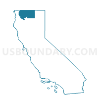
Outline

Summary
| Unique Area Identifier | 544308 |
| Name | Voting District 10030 |
| County | Siskiyou County |
| State | California |
| Area (square miles) | 886.17 |
| Land Area (square miles) | 882.36 |
| Water Area (square miles) | 3.81 |
| % of Land Area | 99.57 |
| % of Water Area | 0.43 |
| Latitude of the Internal Point | 41.66632420 |
| Longtitude of the Internal Point | -121.78397750 |
Maps


Graphs
Select a template below for downloading or customizing gragh for Voting District 10030, Siskiyou County, California


Neighbors
Neighoring Voting District (by Name) Neighboring Voting District on the Map
- Voting District 10005, Siskiyou County, CA
- Voting District 10010, Siskiyou County, CA
- Voting District 10025, Siskiyou County, CA
- Voting District 10035, Siskiyou County, CA
- Voting District 10065, Siskiyou County, CA
- Voting District 50075, Modoc County, CA
- Voting District 50090, Modoc County, CA
Top 10 Neighboring County Subdivision (by Population) Neighboring County Subdivision on the Map
- Montague CCD, Siskiyou County, CA (4,105)
- Butte Valley CCD, Siskiyou County, CA (1,955)
- Tulelake CCD, Siskiyou County, CA (1,458)
- McCloud-Medicine Lake CCD, Siskiyou County, CA (1,409)
- Newell CCD, Modoc County, CA (1,076)
- Adin-Lookout CCD, Modoc County, CA (834)
Top 10 Neighboring Place (by Population) Neighboring Place on the Map
Top 10 Neighboring Elementary School District (by Population) Neighboring Elementary School District on the Map
- Weed Union Elementary School District, CA (4,044)
- McCloud Union Elementary School District, CA (1,353)
- Little Shasta Elementary School District, CA (332)
Top 10 Neighboring Secondary School District (by Population) Neighboring Secondary School District on the Map
Top 10 Neighboring Unified School District (by Population) Neighboring Unified School District on the Map
- Tulelake Basin Joint Unified School District, CA (2,512)
- Butte Valley Unified School District, CA (2,036)
- Big Valley Joint Unified School District, CA (1,802)
Top 10 Neighboring State Legislative District Lower Chamber (by Population) Neighboring State Legislative District Lower Chamber on the Map
Top 10 Neighboring State Legislative District Upper Chamber (by Population) Neighboring State Legislative District Upper Chamber on the Map
Top 10 Neighboring 111th Congressional District (by Population) Neighboring 111th Congressional District on the Map
Top 10 Neighboring Census Tract (by Population) Neighboring Census Tract on the Map
- Census Tract 3, Siskiyou County, CA (4,105)
- Census Tract 2, Siskiyou County, CA (1,955)
- Census Tract 2, Modoc County, CA (1,910)
- Census Tract 1, Siskiyou County, CA (1,458)
- Census Tract 12, Siskiyou County, CA (1,409)